0326 TOPOGRAPHIES OF EMERY RE:FORM#2 COMPETITION
Description
Reimagining The Emery Landscape Of Naxos
Emery (smirida or smyrigli), beyond being a significant mineral resource for the island of Naxos, constituted a fundamental axis in the island’s social, political, and economic formation. It functioned
as a pillar of social organization, a symbol of collective identity, a political “instrument,” and one of the primary sources of income for the mountainous villages of Naxos. For decades, it shaped the everyday life of these communities and operated as a mechanism of collective cohesion, sustaining settlements that were otherwise
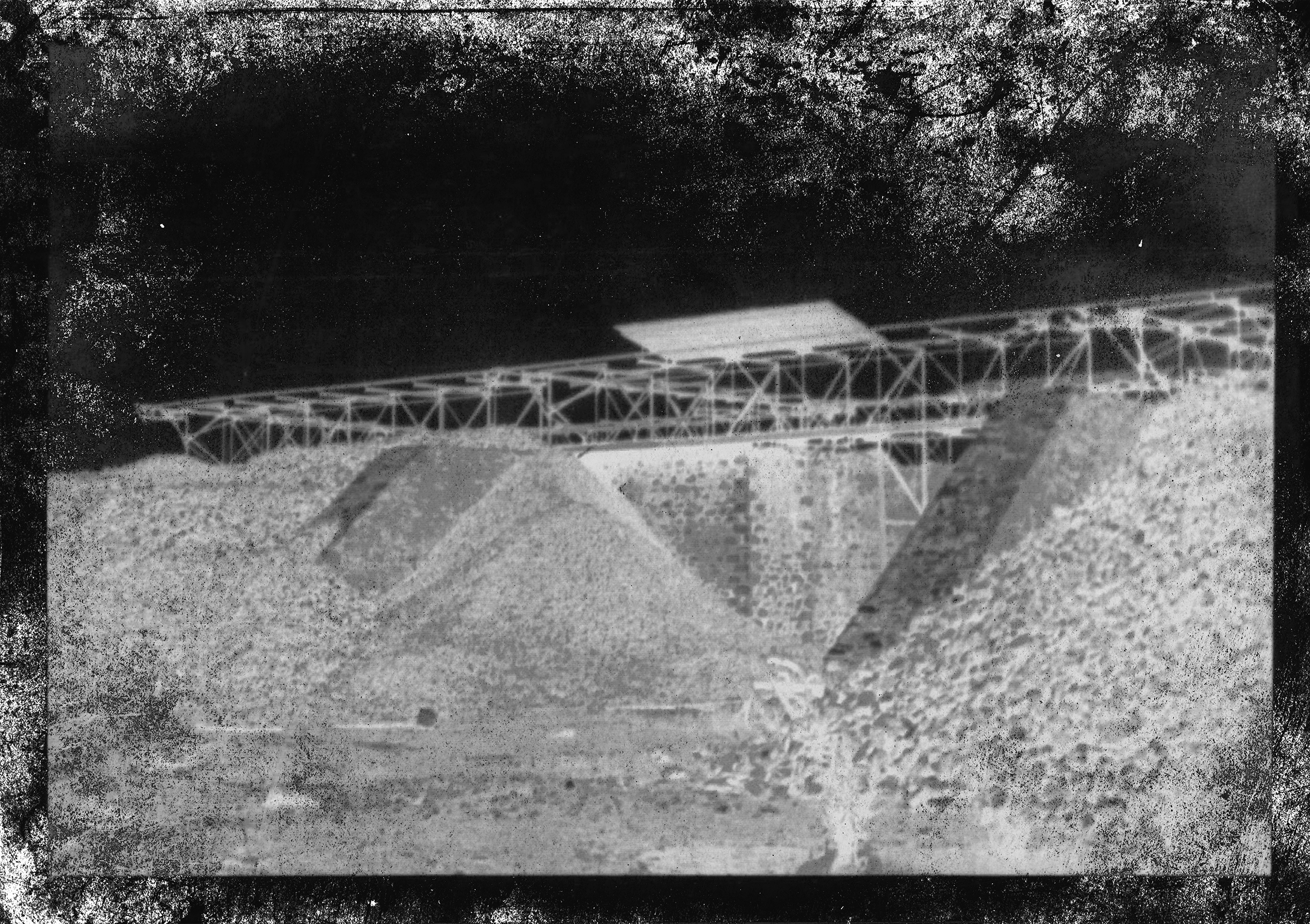
threatened by abandonment. Historically, emery was among Greece’s most important export products. A pivotal point in this narrative was the port of Moutsouna, which served as the main collection and export hub for emery and remains inseparably
linked to the history of emery mining during the 20th century. Today, emery extraction survives primarily as memory: as cultural heritage, as an industrial imprint inscribed on the landscape, and
as an intangible body of knowledge, narratives, and practices.
This proposal seeks to reinterpret emery mining as an active historical narrative—one capable of being rearticulated in response to contemporary environmental, social, and cultural conditions. Acknowledging the environmental impacts of extraction—soil erosion, vegetation loss, ground disturbance, and disruption of the local water balance—the project proposes nature itself as the primary tool for restoration and transition.
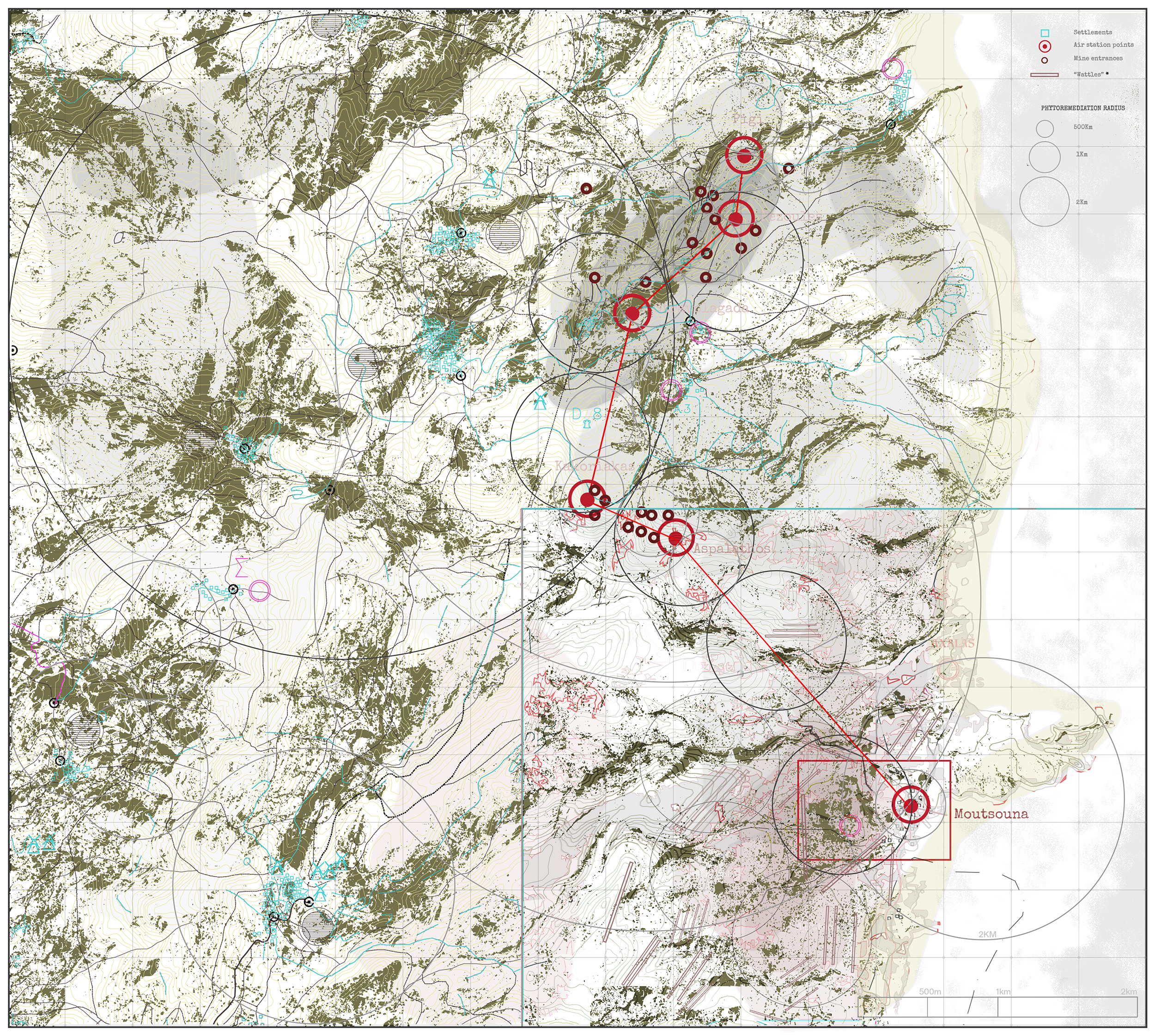
The project is structured around three conceptual pillars: Environmental, through phytoremediation and sustainable land-use strategies; Social, through the reactivation of the landscape as a field of contemporary presence and productive activity; Cultural, through the revalorization of the industrial and pastoral history as a living narrative. The intervention unfolds as a circular network
structured around two complementary strategies.
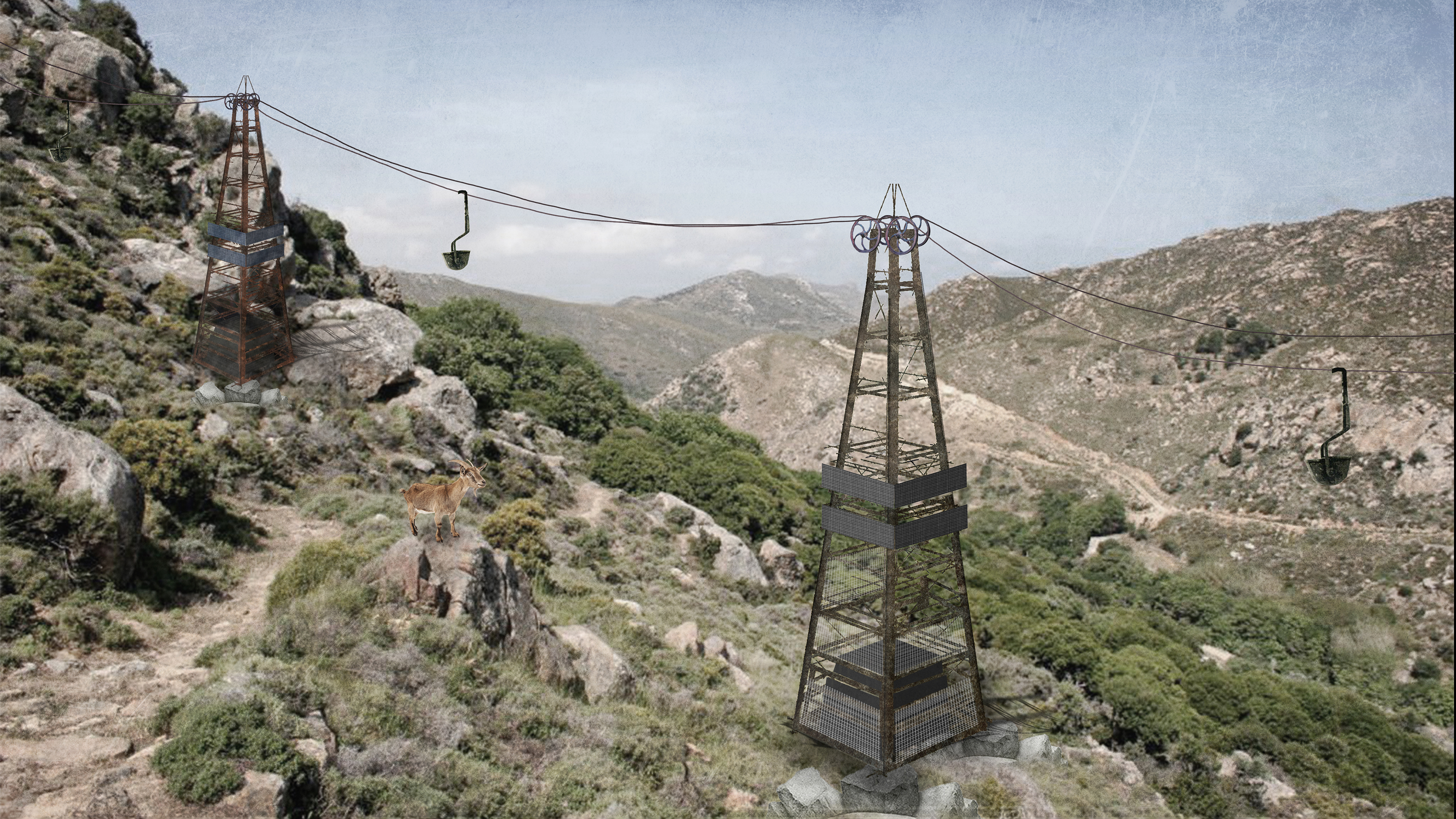
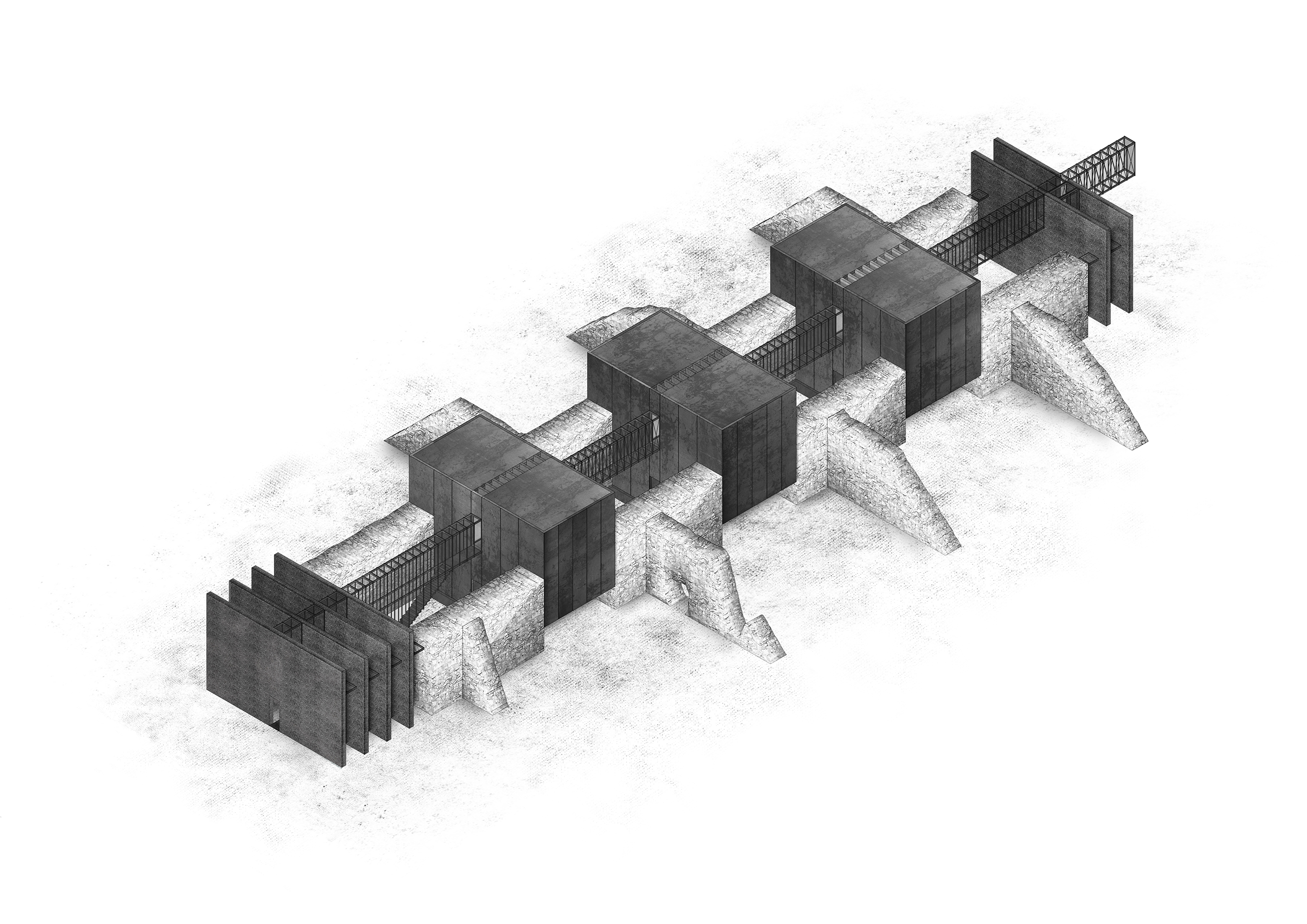
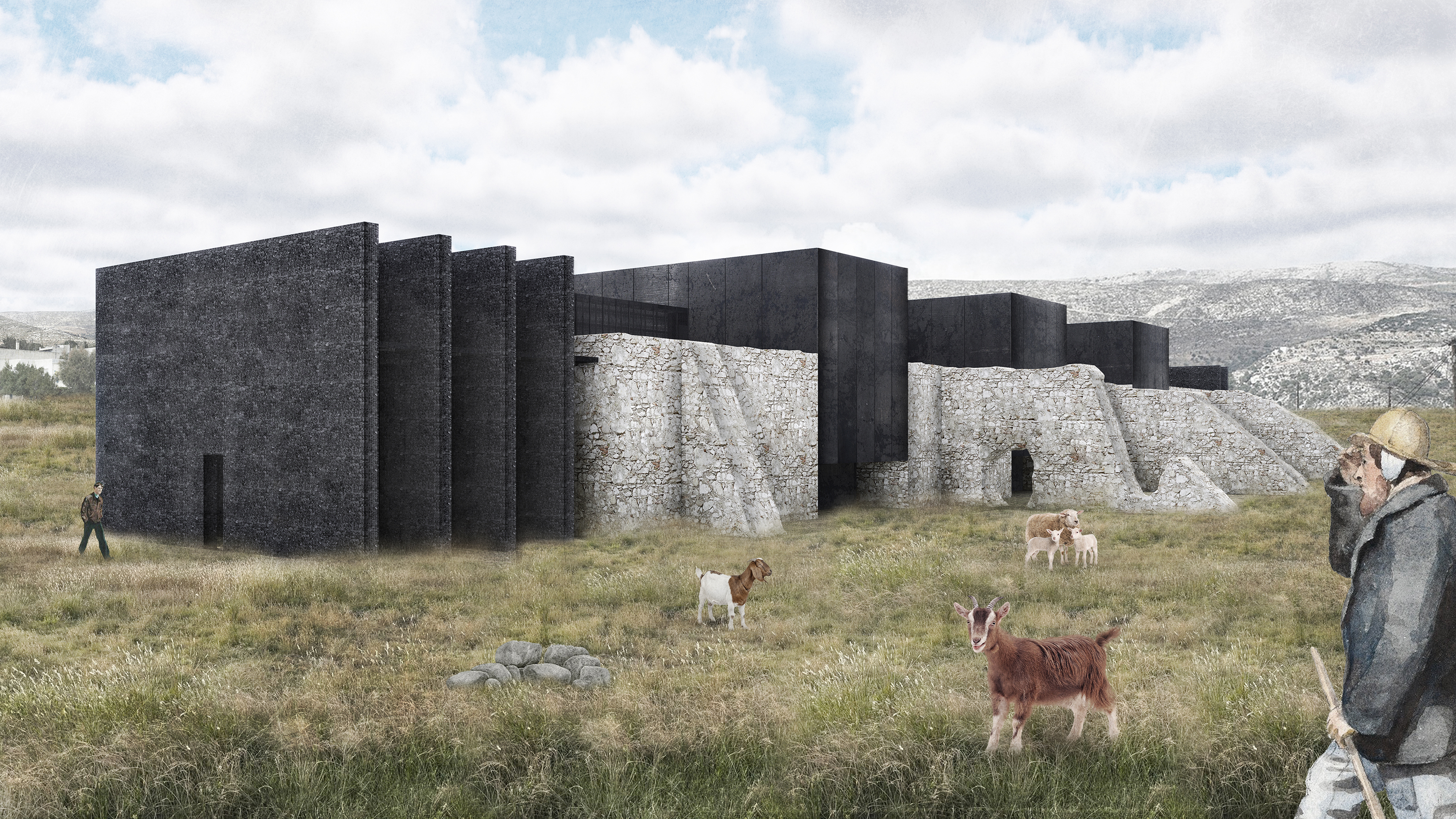
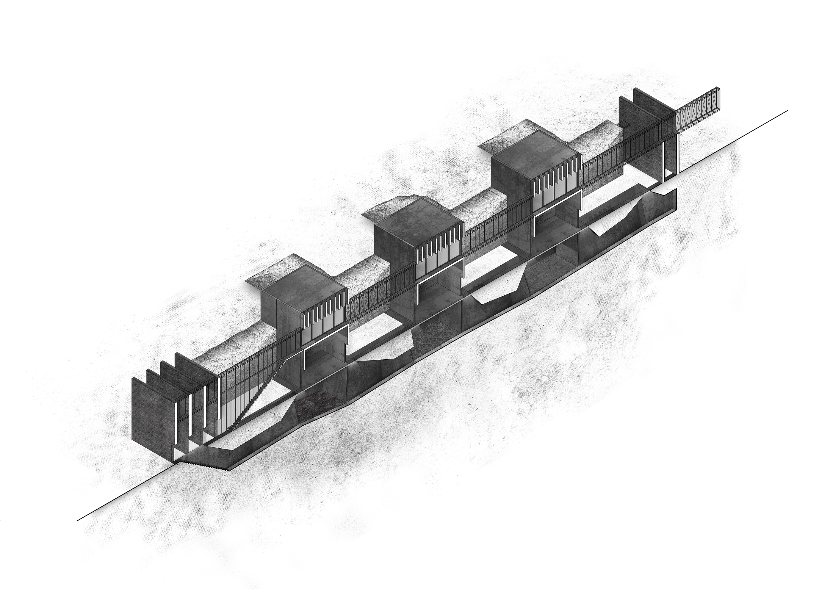
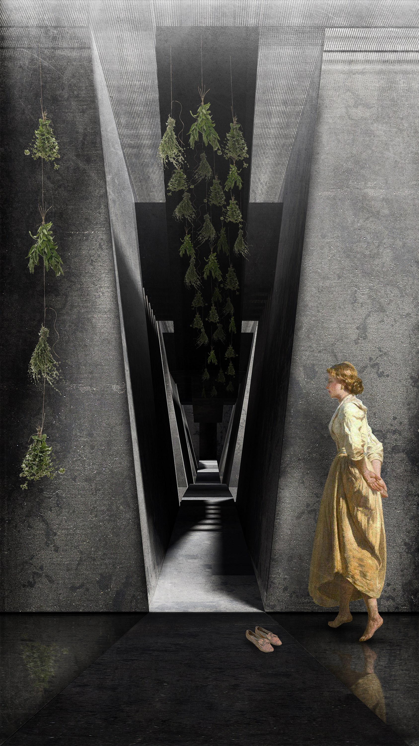
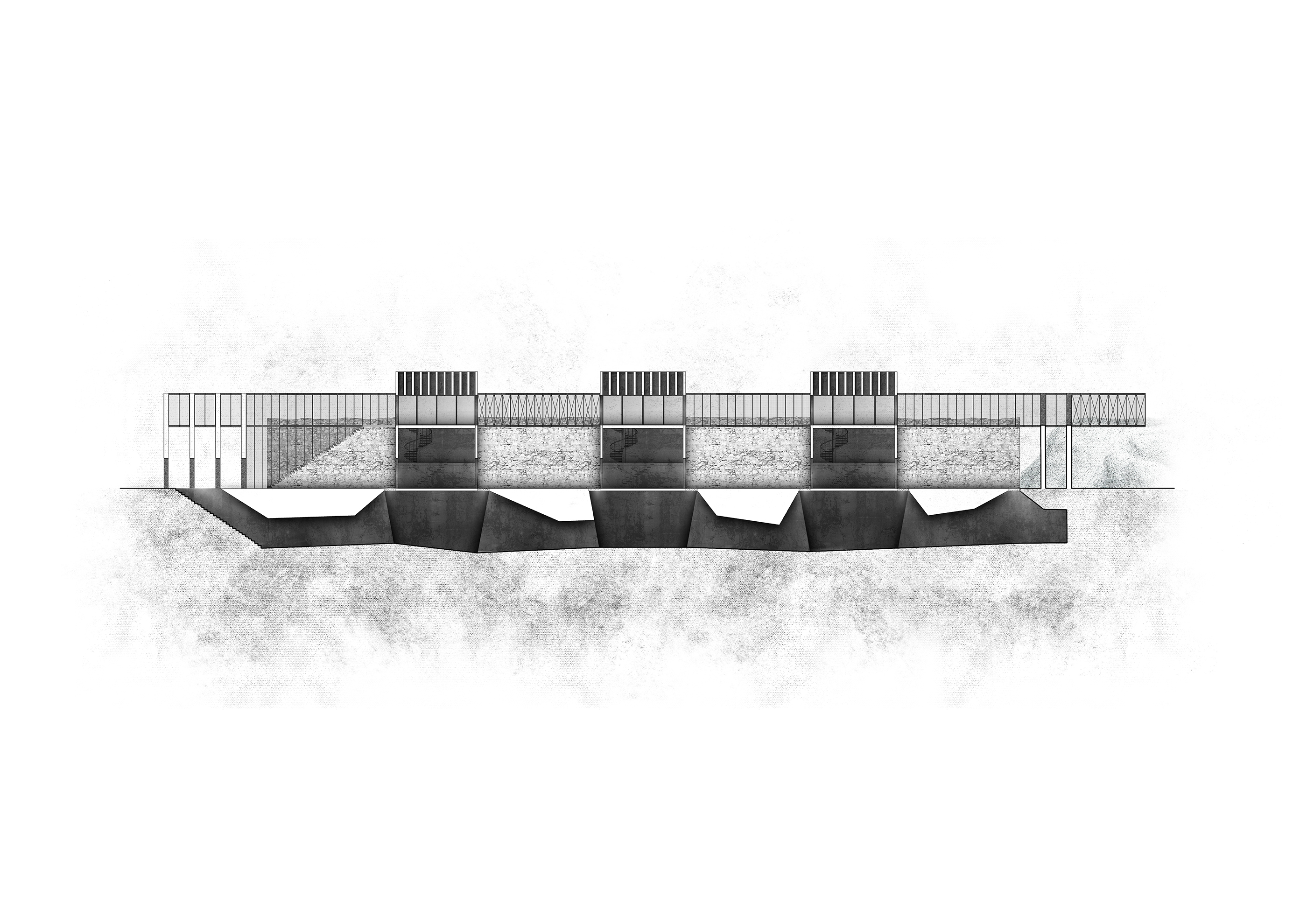
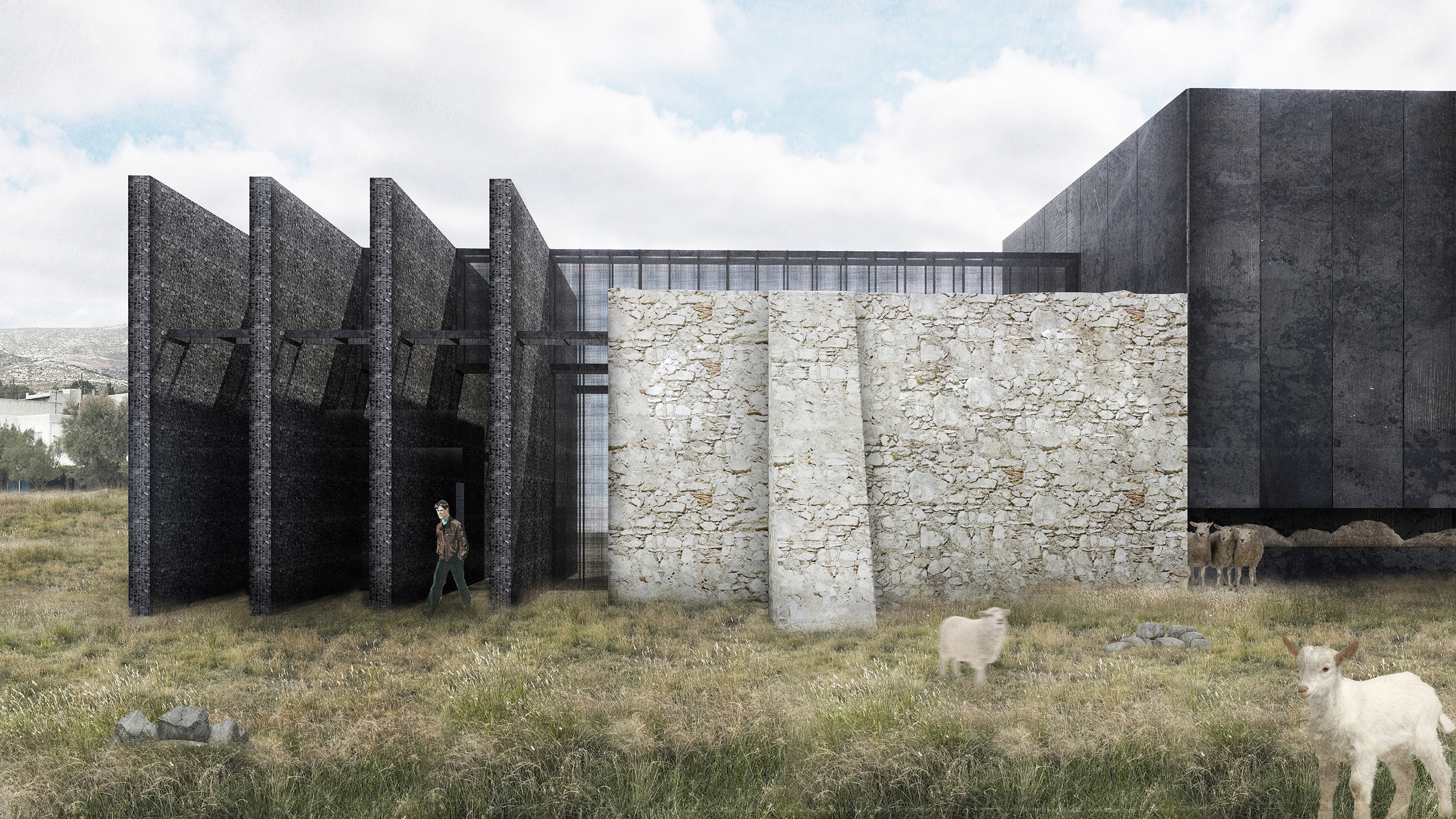
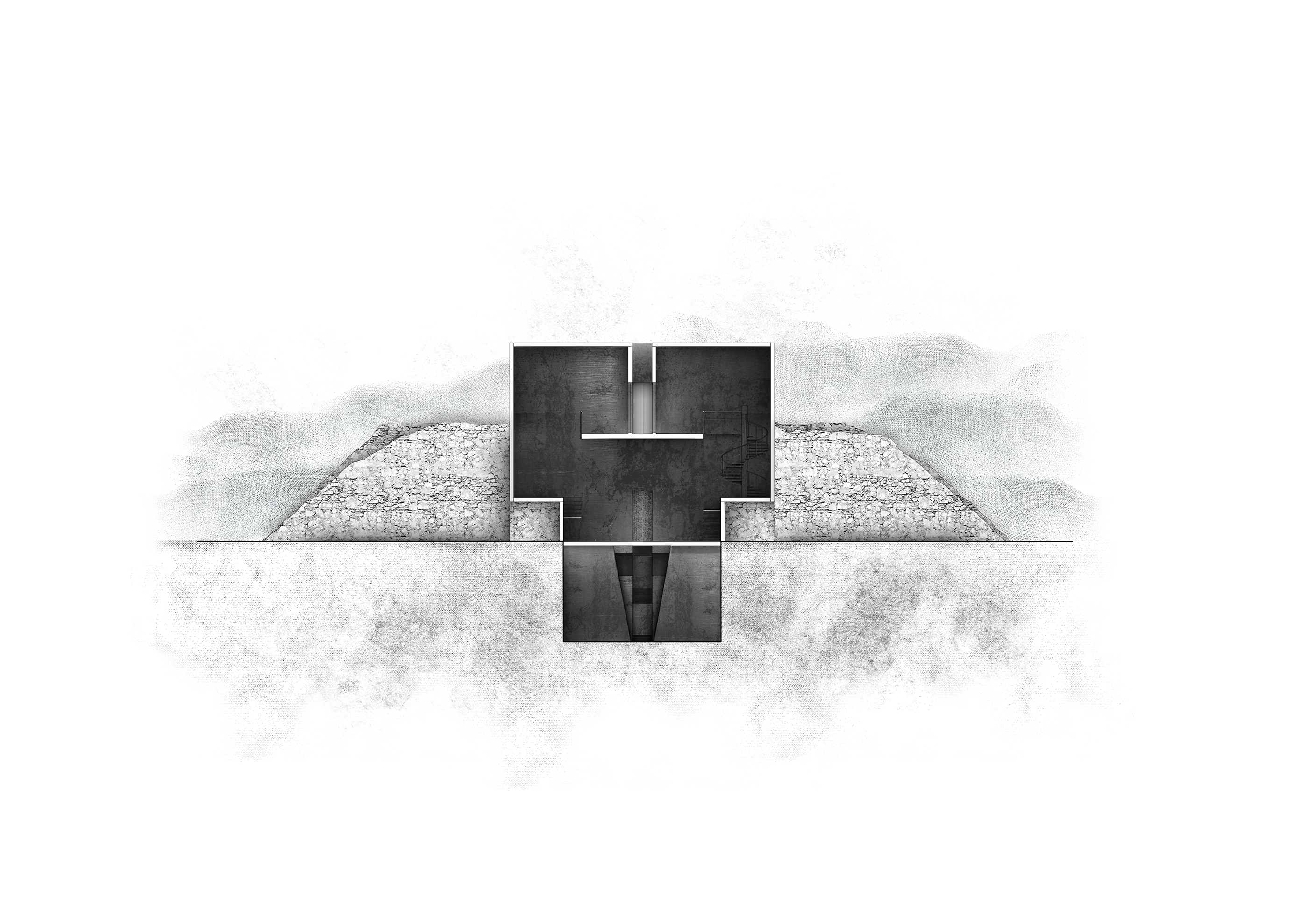
The first focuses on the remediation of soil, water, and atmosphere through phytoremediation using endemic herb species. The second strategy introduces hybrid agro-pastoral mechanisms, reusing the existing ruins of the emery mining infrastructure—pillars, cableway towers, and the collection station at Moutsouna. The pillars of the former aerial cableway are reinterpreted as “air wells”—devices that harvest water from atmospheric humidity, air condensation, and rainfall—supplying the wider network. At the same time, a mobile seed-dispersal mechanism, referencing the historical cableway towers, operates as a pilot system for the gradual phytoremediation of the landscape. The former emery collection station at Moutsouna is repurposed as a laboratory for the processing and promotion of botanical products, organized into three distinct stages: collection, extraction and drying, and distribution. In this way, pastoral practices are reintroduced as part of a contemporary productive cycle. Surrounding the existing structure, a hybrid system of adaptive grazing is established, closely linked to the laboratory and providing water and nourishment for livestock.
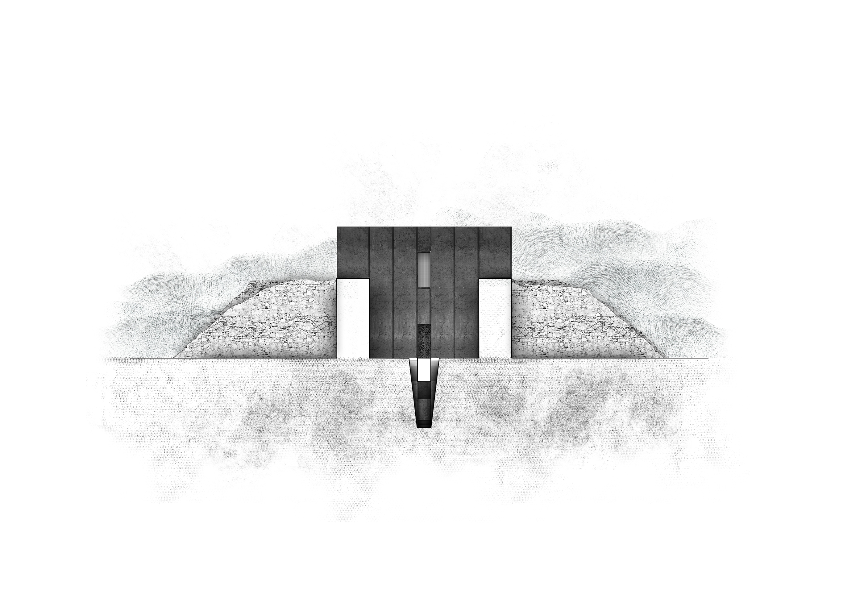
The spatial experience of the site unfolds as a narrative sequence, guiding the visitor through an underground–aerial route that reveals the layered relationship between landscape, industry, and ecology. The proposal ultimately transforms a marginalized and wounded landscape through the regenerative processes of nature itself. Through an architectural approach that draws strength from absence, erosion, and the ground, the project negotiates between memory and renewal, preserving the geological and social significance of emery while introducing a new topography of care, resilience, and sustainability.
“WATTLE” – pipes filled with straw and composted livestock waste, shaped like a snake and designed to prevent erosion.
Construction/Erosion:Wattle & Daub: An ancient building technique using interwoven branches covered with mud or clay. Straw Wattles: Cylindrical, biodegradable tubes used in construction to reduce water runoff and trap sediment on slopes. Common Uses: Agriculture/Nature: Identifying bird species (e.g., “double-wattled” cassowary). Environmental Management: Protecting soil from erosion on construction sites.
The proposed system applies a combined regenerative grazing model that uses herd movement as a landscape management tool. Three complementary strategies operate together: herding-based adaptive grazing, attraction-based grazing, and social learning
within the herd. The shepherd acts as a “moving fence”, while elements such as water, salt, and shade are strategically placed to guide grazing across the landscape. Over time, animals learn movement patterns and routes through collective behavior. The
system minimizes permanent infrastructure and allows the landscape to function as a dynamic ecological field where grazing supports soil regeneration, vegetation recovery, and spatial balance.
SEED DISPENSING MECHANISM & WATER TOWER | FOG AND AIR CATCHERS
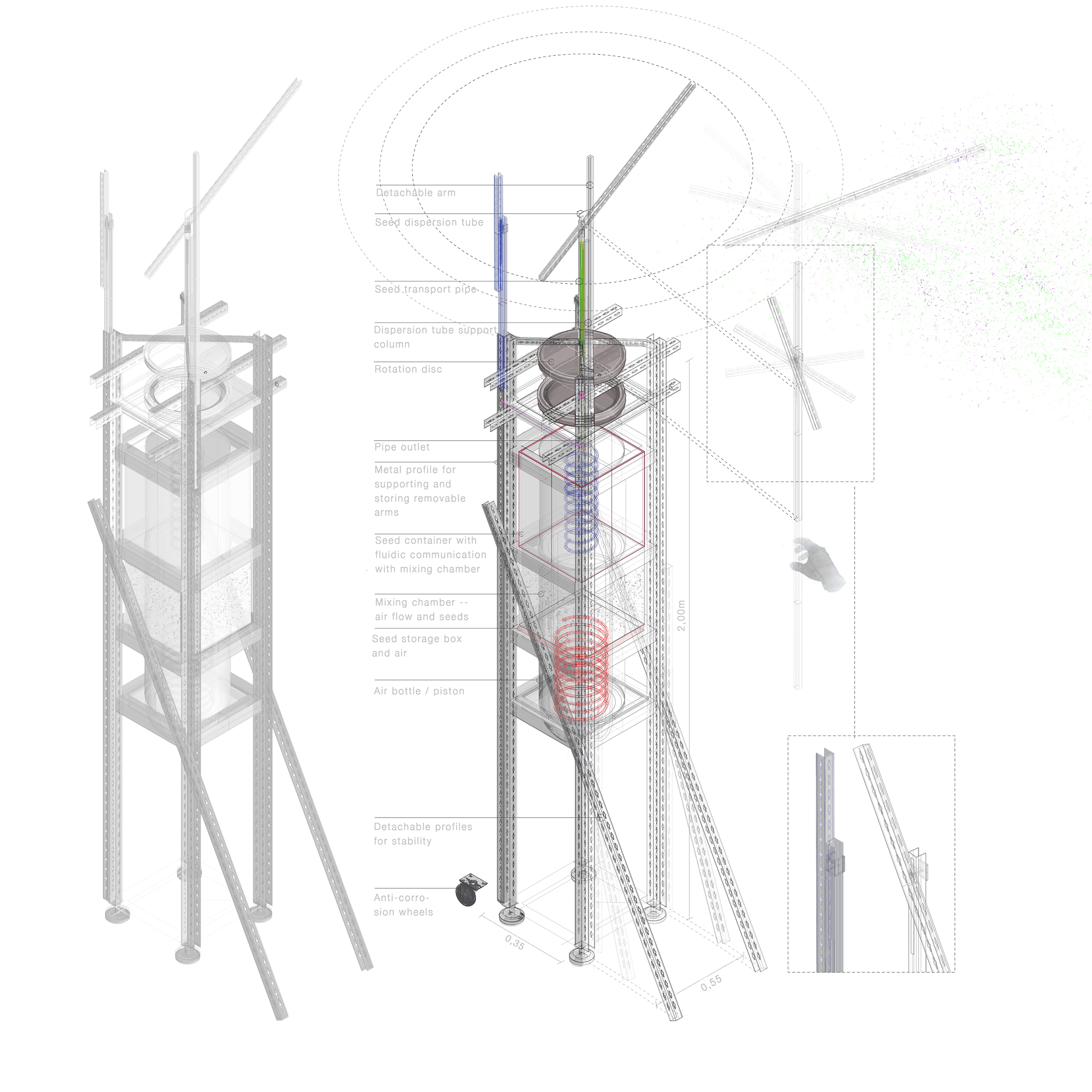
01 | The phytoremediation system is an autonomous seed dispersal mechanism that actively contributes to the phytoremediation process. The mechanism is mobile, and the arms are detachable and foldable to save space and make it easier to transport. The patent consists of: An energy storage unit. An air flow generation unit connected to the energy storage unit. A mixing chamber capable of combining air flow with seeds. A detachable seed container in fluid communication with the mixing chamber. At least one flexible or articulated transfer tube connected to the mixing chamber. A manifold capable of supporting multiple outlets. One or more detachable ejection units (“arms”). The arms can be extended or retracted, thus increasing the ejection radius. A transparent tube with seeds is connected to it, which exits the system. The system can be fed with any seed and has an automatic ejection mechanism that is activated by sensors when it detects eroded soil. And interchangeable ejection heads selected from among rotary and directional heads, where the system is functionally independent of an external energy source and capable of adjusting the radius, direction, and form of seed dispersion. The system is made of metal profiles (frame) and transparent wood (limonene) in the seed storage box—the stage before seed mixing.
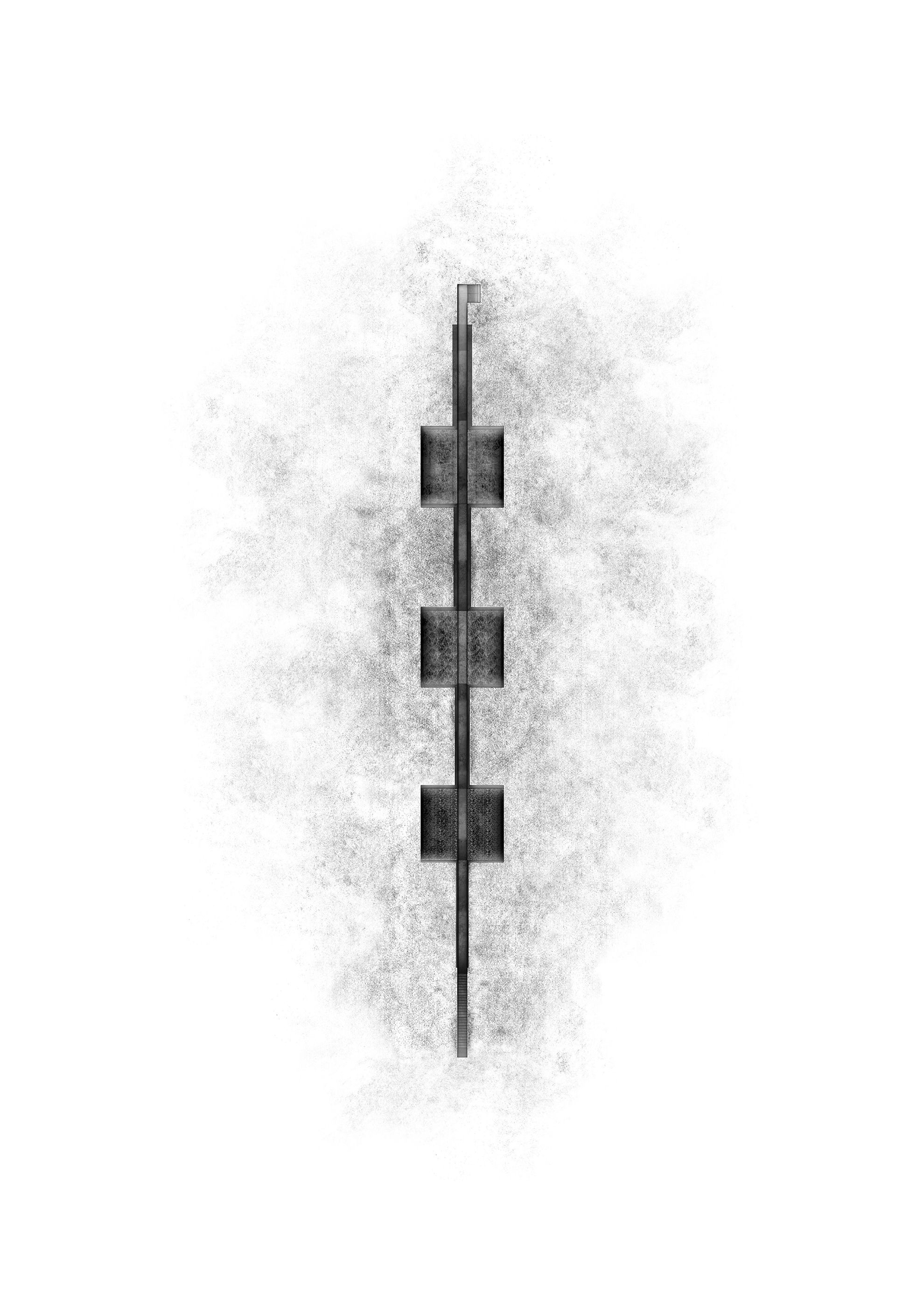
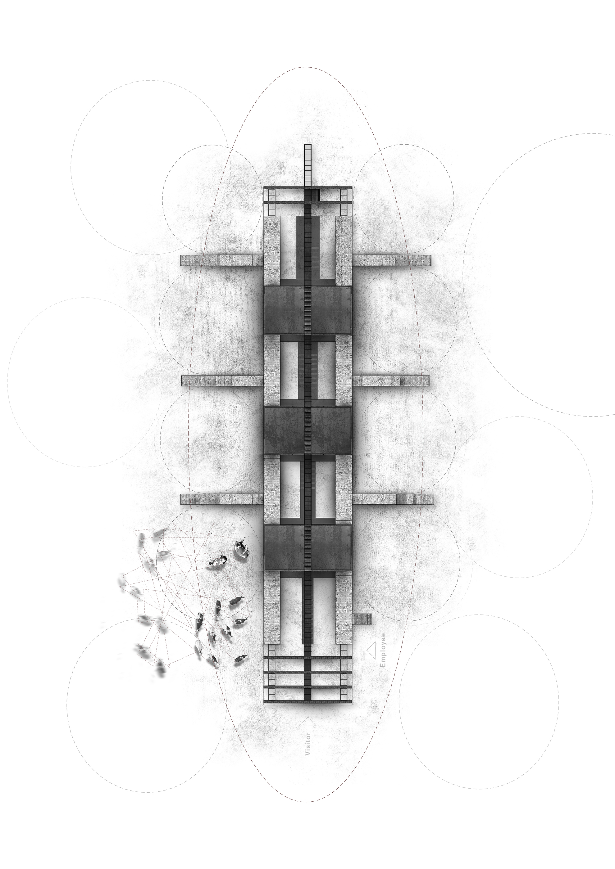
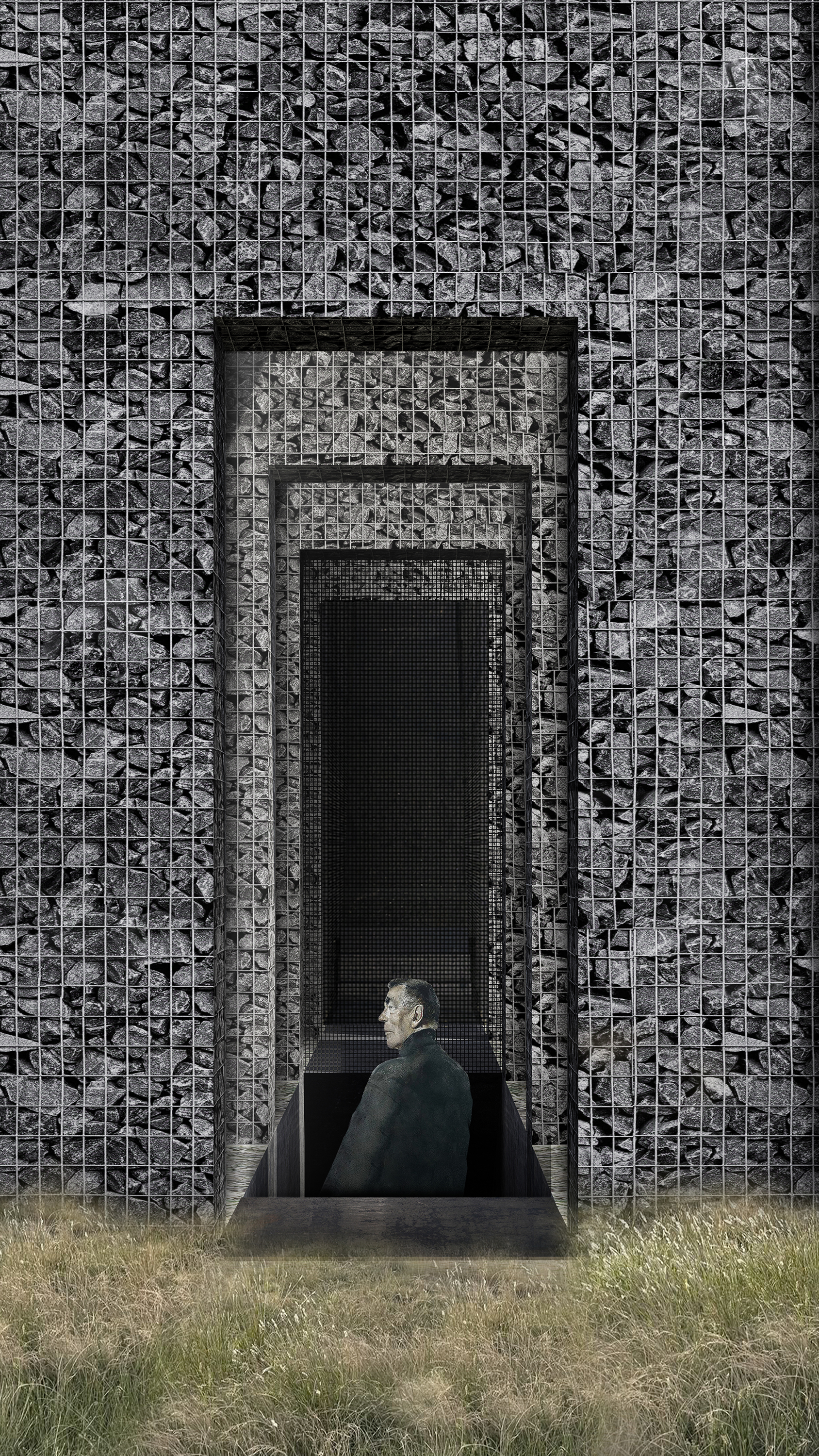
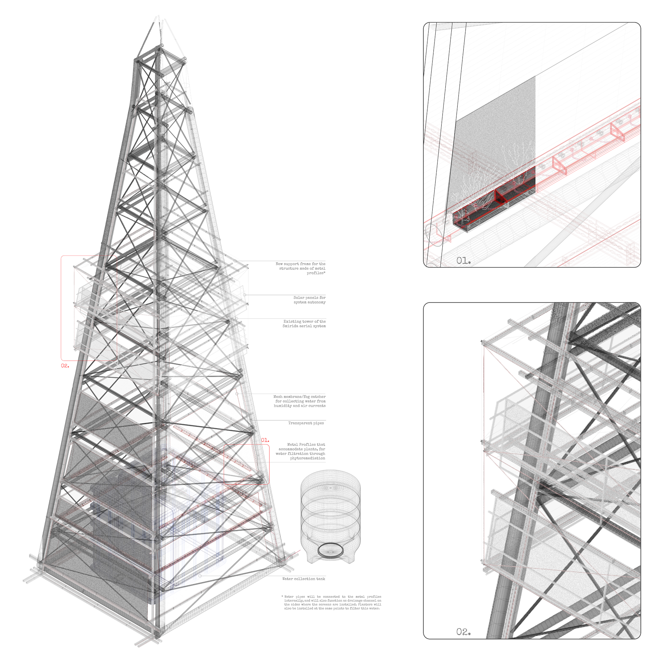
02 | The proposal reinterprets one of the towers of Naxos’ historic aerial emery transport system, transforming it into a vertical infrastructure for water collection, filtration, and storage. The intervention operates as a pilot system that can gradually activate the entire network of towers, forming one of the strategies for managing the island’s increasing water scarcity. A new lightweight metal structure develops around the existing tower, creating a hybrid system that combines infrastructure, energy production, and natural purification processes. In the lower zone, fog-collecting meshes capture moisture from the atmosphere, while in the upper zone photovoltaic panels are integrated to ensure the system’s energy autonomy. The collected water is channeled through the metal profiles, which function as gutters and as a distribution network. In the lower zone, linear planting structures—formed by the same metal profiles— act as natural filters, where the water is purified through phytoremediation before reaching the storage tank at the base of the tower, where it is stored and subsequently distributed for use in the settlement and the surrounding villages of Naxos. The intervention transforms an element of Naxos’ industrial heritage into a contemporary ecological infrastructure, where landscape, energy, and water are interconnected within a self-sufficient and pilot resource-management system.
Space
Space
250 sq.m.
Location
Location
Naxos, Cyclades [GR]
Typology
Typology
Concept
Year of Completion
Year of Completion
2026
Creative Director
Creative Director
Manos Babounis
Design Team
Design Team
Katerina Kyriazopoulou, Paris Fakinos
TRAIL[practice] RE:FORM Competition Board
TRAIL[practice] RE:FORM Competition Board